.png)
Marine navigation system to increase safety, commerce in Northwest
Thursday, June 16, 2022
NOAA’s real-time observations to aid Naval Base Kitsap and mariners
Mariners can breathe a little easier when sailing in and around Naval Base Kitsap in Washington state.
The base is now fitted with a NOAA system that helps ensure safe and efficient marine navigation. The technology is part of a nationwide network called Physical Oceanographic Real-Time System, or PORTS?.
Kitsap PORTS is the 37th system in this network of precision marine navigation sensors, and is the result of a partnership between NOAA and the U.S. Navy. The sensors track oceanographic and meteorological conditions as they unfold around Naval Base Kitsap.
“Precision navigation systems are a critical element of our nation’s data-driven blue economy and help our environment too,” said NOAA Administrator Rick Spinrad, Ph.D. “The real-time information tracked by PORTS systems allows vessels to move safely within U.S. waterways to make operations more efficient and lower fuel consumption, which also lowers carbon emissions.”
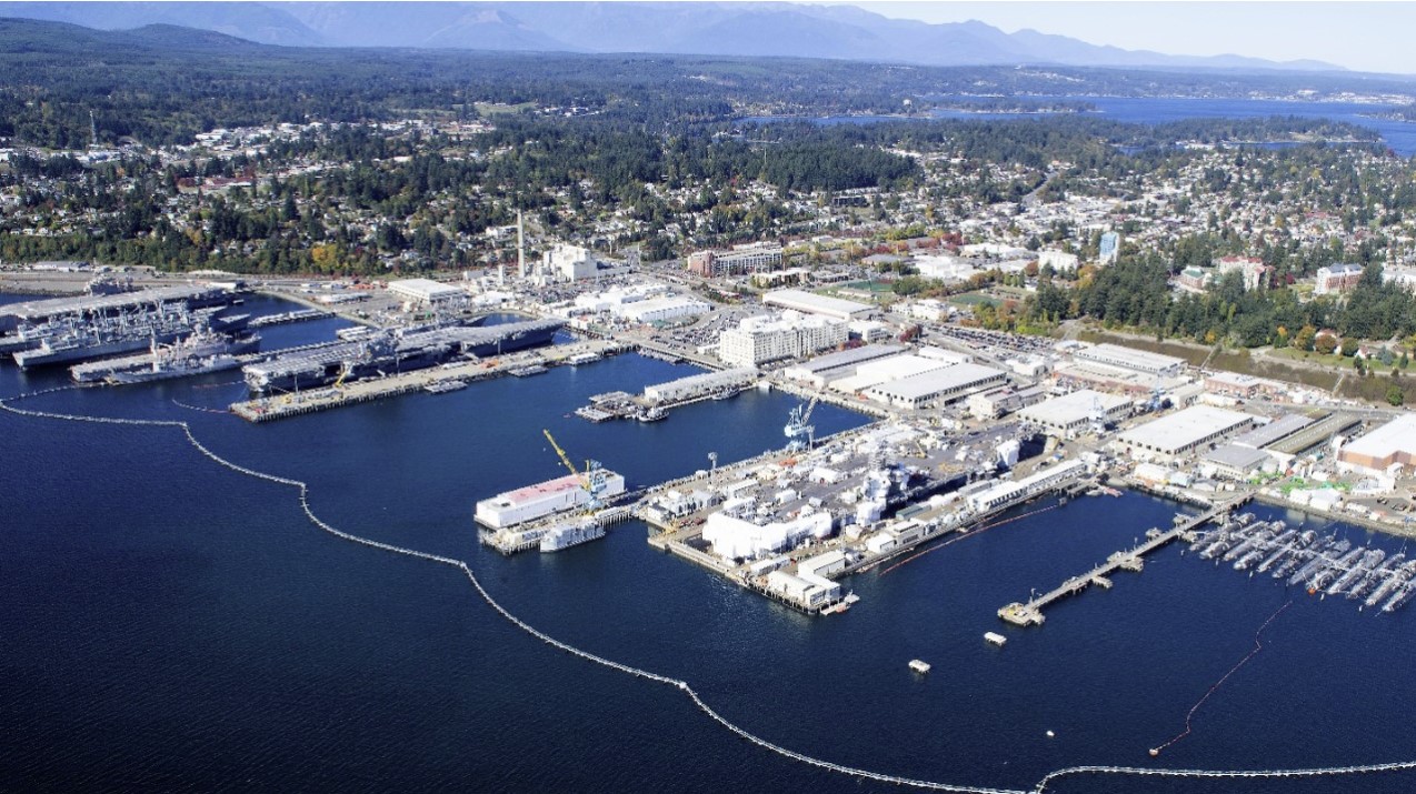
Naval Base Kitsap is the nation’s third-largest U.S. Navy installation and provides base operating services to submarines, aircraft carriers, Puget Sound Naval Shipyard and the largest fuel depot in the Continental U.S. The Kitsap PORTS will help personnel plan for, and respond to, changing oceanographic conditions in the area. The system will allow all local mariners to have access to real-time water level, currents, and meteorological information, helping them better plan vessel transits and prevent accidents.
The systems measure and disseminate predictions and observations for a variety of oceanographic and meteorological conditions. The NOAA PORTS program has reduced shipping collisions, groundings, injuries and property damage. When a new PORTS is designed, local stakeholders determine the sensor type and location requirements to support their safety and efficiency decisions.
“This new system, and the others like them around the country, reduce ship accidents by more than 50%, increase the size of ships that can get in and out of seaports and reduce traffic delays,” said Nicole LeBoeuf, director of NOAA’s National Ocean Service. “They also provide real-time data as conditions rapidly change, giving our coastal communities time to prepare and respond.”
The Kitsap PORTS consists of an integrated series of sensors which provide critical real-time information on oceanographic and meteorological conditions. This will greatly increase the navigation safety of vessels entering and exiting Puget Sound and traversing both Rich Passage and the Hood Canal.
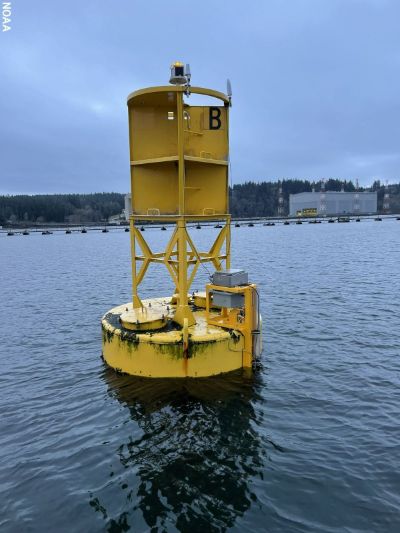
Two new current meters collect and transmit real-time current observations in waterways with dynamic currents and large depth changes over small distances. A new water level and meteorological monitoring station will aid mariners navigating the area around Bremerton, Washington, which observes a very large daily tidal range. Wind speed and directional data will help users plan for safe docking in high shipping traffic or adverse weather.
Category: NOAA, Naval Base Kitsap, Exports, Navigation, Defense


.png)

.png)


.png)